


Models
 We have developed the following models (Open Source GNU GPL):
PCR-GLOBWB 1.0: the first version of the global hydrological model PCR-GLOBWB that is used to model global terrestrial hydrology and operates at 0.5o globally and daily time steps. It is coded in PCRaster.
The water balance model (no routing, no water use) is available from the following public repository:
https://github.com/UU-Hydro/PCR-GLOBWB_model
This version does not include the dynamic routing scheme and the human water use. For this we refer to PCR-GLOBWB 2.0
PCR-GDEM : PCRaster scripts used to estimate human water demand from socio-economic data (land cover, GDP, population density, electricity use etc.), at monthly time steps and at 0.5o globally. For obtaining these scripts we refer to its primary author Yoshihide Wada.
PCR-GLOBWB 2.0: Is a integrated global hydrology and water resources model. It operates at 5 minutes globally and is coded in PCRaster-Python. PCR-GLOBWB 2.0 fully integrates water demand calculations and then add at run-time demand-drivenwater withdrawal, consumptive water use and return flows as part of the global hydrological cycle. It includes over 6000 reservoirs from the GranD database and has dynamic routing of surface water (simplified by a characteristic method and more involved with Kinematic wave). It also includes a simplified flooding scheme and a water temperature module.
PCR-GLOBWB 2.0 is available from the following public repository:
https://github.com/UU-Hydro/PCR-GLOBWB_model
For example input and parameter files and configuration files (Rhine catchment) we refer to:
https://github.com/UU-Hydro/PCR-GLOBWB_input_example
 A hyper-resolution parallelized version of PCR-GLOBWB 2.0 is being developed with the aim to model the terrestrial water cycle at 1 km or below. We also attach a groundwater flow model to this version. We are working together with the TU Delft in the NWO/Surf funded program eWaterCycle.
Recent developments include coupling with a 5-minute 2-layer groundwater model:
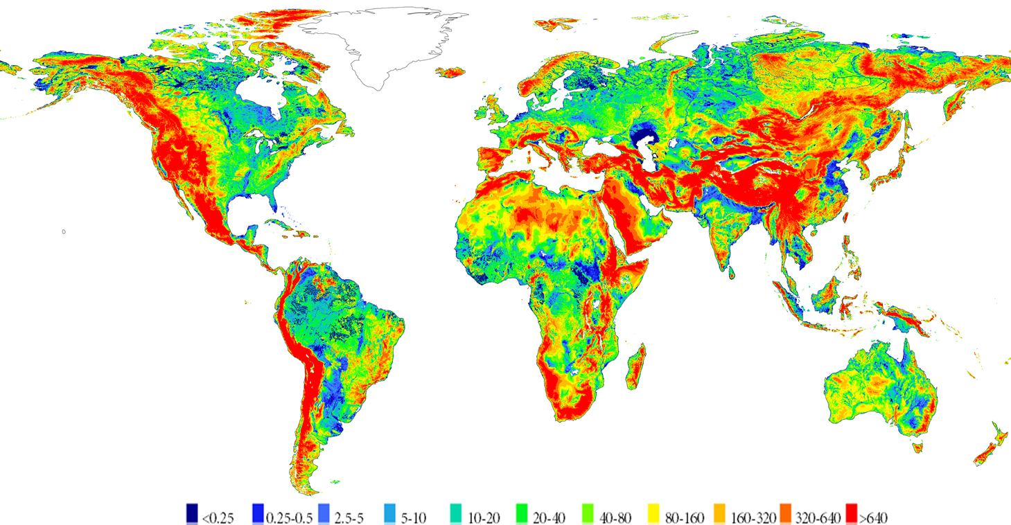
Long-term average groundwater depth (m below surface)